
With the lock downs compounded by the California wildfires I was getting a little stir crazy at the house. I was doing good until the backcountry pretty much got secured to reduce the possibility of more wildfires so when my buddy Mike put together a hiking trip to Mt Charleston, I jumped at it. My usually summer go to of the eastern sierras was off the table, so I got to do a mountain I have wanted to try for a while, but Las Vegas kept getting in the way, haha.
Mt Charleston you see is the big mountain west of Las Vegas and bout an hour away from the strip and the summit sits at 11,916 feet with temperatures usually much cooler than Vegas so it becomes a very popular hiking destination. It is the highest mountain in Clark County and is the eighth highest mountain in the state, it is the most topographically prominent peak in the state of Nevada. The Mount Charleston Wilderness is located in the Spring Mountain National Recreation Area of the Humbolt-Toiybe National Forrest.

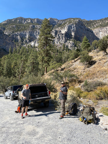
While I had been hiking a lot in San Diego I had not done any major distance or altitude all summer, this was going to be “fun”… After a nice little side adventure driving out to Vegs the night before (read about it here) I got in at midnight we and we were asleep by two am and up at seven, because this is “fun”… We loaded up and headed out to pick up other Mike this made remembering names a lot easier, and then headed to the mountain.

W parked at the Mary Jane Trailhead and after a few minutes of getting our stuff together headed up Trail Canyon the North Trail with the plan of basically doing a loop. It was pretty much all uphill from the start and we ran into a few hikers and horseback riders on our way up. It was a heavy mix of trees and the further we went up the yellow leaves of fall aspen where everywhere and it was an amazing view the entire hike especially as we gained altitude and could see more of the canyon and the peak.

From what we had mapped this was supposed to be a sixteen-mile hike with us summiting day one and camping on or near the peak. I had packed heavy planning for possible weather changes especially in a new area. I turned out that this part of the trail was quite step and was one of those “how does the trail go there type of places until you are hiking along the steep edges and the well carved out trail”. At about three miles in we stopped for a break and water at what was going to turn out to be the only water spot on the trail, I was very glad later that we had filled up everything again.

I was sucking wind and feeling the altitude, so I made sure to slow down and drink lots of water, our plan to hit the summit that day was a little optimistic. But I will tell you the view was worth it as we climbed into the bristle cone pines and where treated to some amazing rock formations. After doing the math we figure we would set up camp, so we had some day light and time to relax and grab chow.

We began the hunt for a good spot and while we were only a group of three space was definitely limited up there, it’s like finding a good hotel on a road trip you don’t want to stop too soon but you also don’t want to keep going and have to head back. After finding a good spot we set down and one of the Mikes took off a little down the trail just to make sure there wasn’t anything better, there wasn’t. We ehre about a mile and a half from the summit and could see the Devils Thumb, as we set up camp it began to get a little chilly.

Setting up camp wasn’t too bad and the Mikes where set up for ultralight backpacking, so it was fun watching them get their gear together and set up. We were treated to an amazing sunset as we cooked dinner and planned for the following day. It was a great night with some good company.
